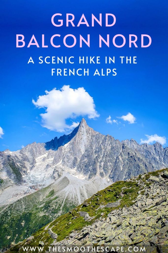
Grand Balcon Nord, a scenic alpine walk in Chamonix

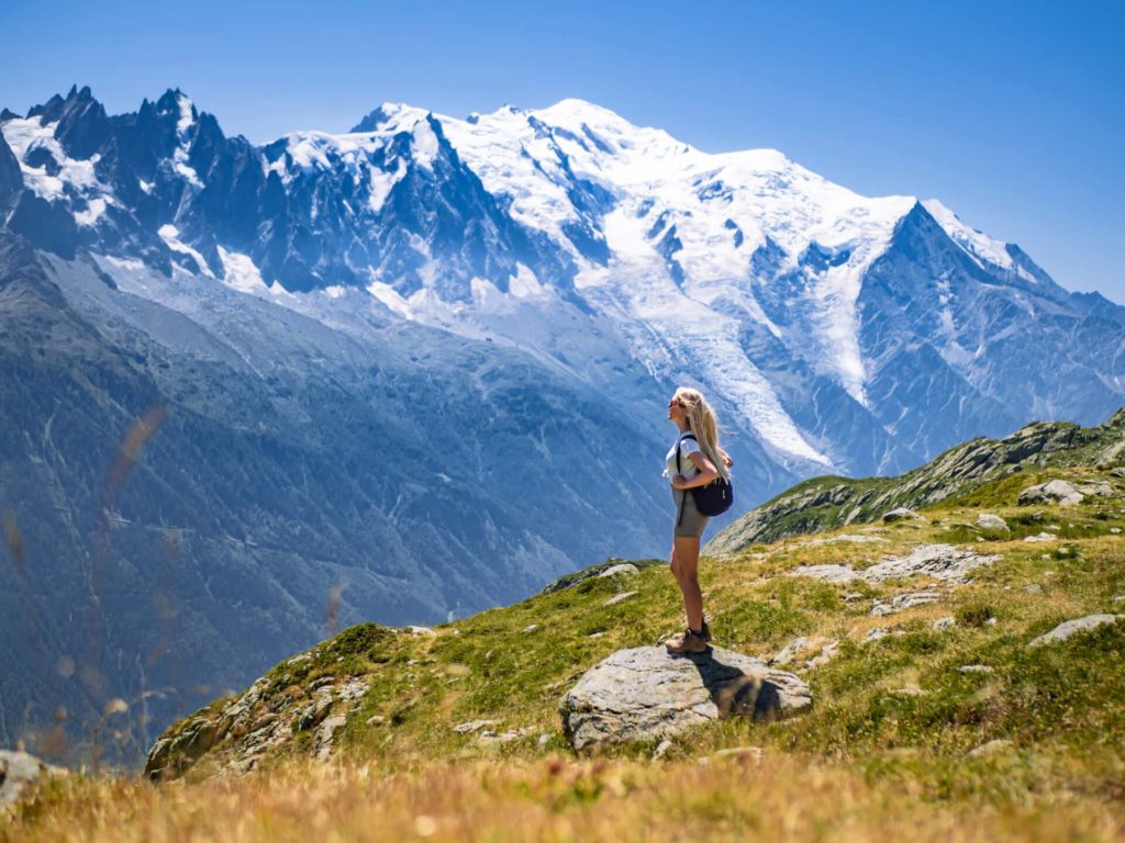
The Grand Balcon Nord hike is one of the most beautiful day hikes in the French Alps. It extends across the southern slope of Chamonix Valley, providing spectacular views of the surrounding alpine scenery, the iconic Mont Blanc and France’s largest glacier Mer de Glace.
With a distance of 6.2 km (3.8 mi) and little elevation gain, Grand Balcon Nord allows you to experience the raw natural beauty of the Alps without having to hike for too many hours on end. Walking this classic trail is one of the best things to do in Chamonix for everyone that enjoys being active and spending time outdoors like me!
In this guide, I’ll take you through everything you need to know to successfully hike this trail. At the end of the post, I’ve also included a Grand Balcon Nord map where you can see the precise walking route.
Disclosure: This article contains affiliate links from which I may make a commission at no additional cost to you if you make a purchase.
Grand Balcon Nord hike details
Type of hike: Point-to-point
Trailhead: Plan de l’Aiguille
End of the trail: Montenvers
Distance: 6.2 km (3.8 mi)
Elevation gain: 140 m (459 ft)
Difficulty: Easy/moderate
Time: Around 2.5 hours
Note: A common misunderstanding many people have is that Grand Balcon Nord is located on the northern side of the Chamonix Valley (because its name includes ‘Nord’). Actually, it’s on the south side. The name ‘Grand Balcon Nord’ indicates the direction the ‘balcony’ faces, not its location in the valley.
P.S. In case you’re looking to do more scenic walks in the area, don’t miss my post on the Lac Blanc hike, my favorite hike in Chamonix!
Grand Balcon Nord hiking guide
The route that I’ll describe in this post begins at Plan de l’Aiguille and ends at Montenvers. It is also possible to walk it in the opposite direction. However, it would be more challenging as you’d have to hike more uphill, plus the sun would be shining straight into your face.
The way up to Plan de l’Aiguille
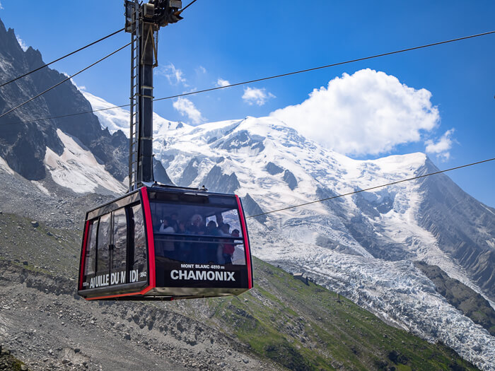
To get to the starting point of the Grand Balcon Nord trail, you need to ride the Aiguille du Midi cable car from Chamonix up to Plan de l’Aiguille, which is the middle station. See the ticket prices and schedules here.
Alternatively, you could also ride the cable car all the way up to visit Aiguille du Midi, a famous mountain peak with a height of 3,842 m (12,605 ft) and one of the most popular attractions in Chamonix. It’s the closest you can get to Mont Blanc without climbing. For more info about Aiguille du Midi, read my post on the top things to do in Chamonix.
After exploring Aiguille du Midi, take the cable car down again to the mid-station (Plan de l’Aiguille) and begin your Grand Balcon Nord hike.
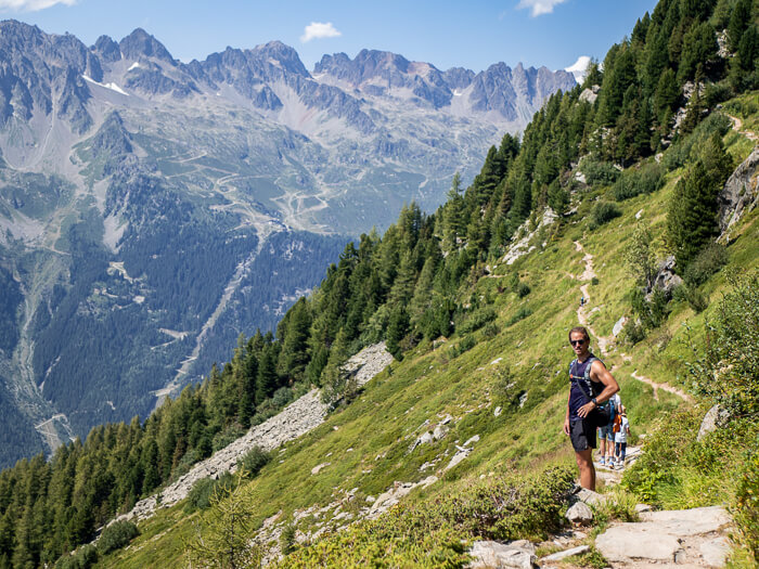
Hiking the Grand Balcon Nord towards Montenvers
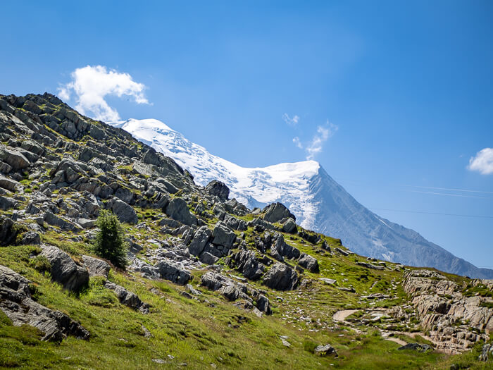
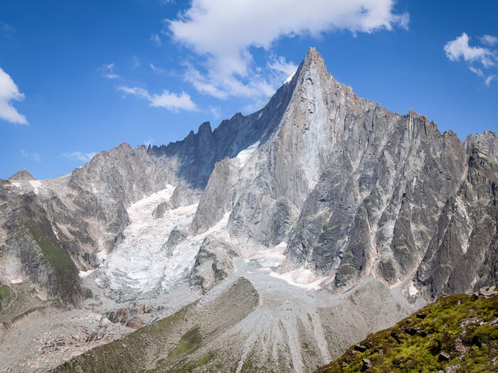
At Plan de l’Aiguille, you’ll be greeted with magnificent views of Mont Blanc, Aiguille du Midi and the giant Bossons glacier pouring down Mont Blanc’s northern side.
There’s also a small café selling snacks and drinks. You’ll find the trailhead right next to the café, marked with a signpost with arrows pointing in different directions. Follow the one pointing to Refuge du Plan de l’Aiguille/Montenvers Mer de Glace.
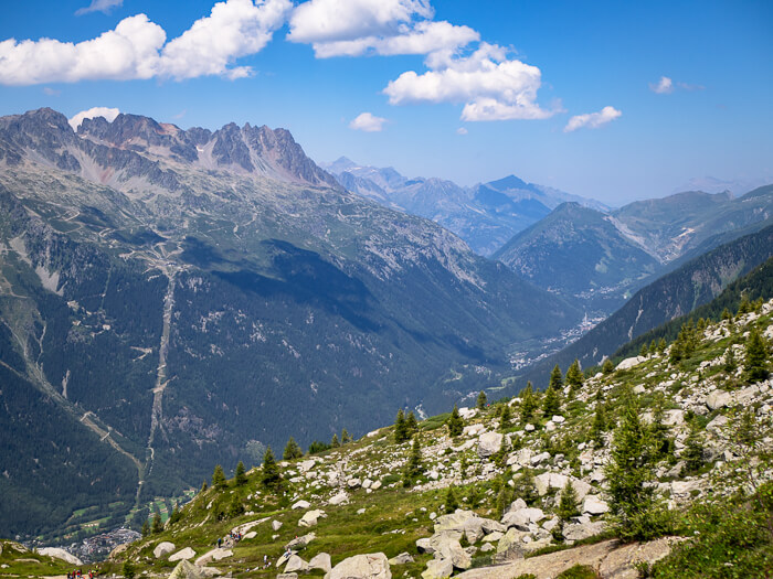
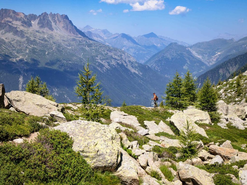
Over the next hour or so, the path gently descends, crossing a few small streams and meandering through beautiful alpine grasslands. On this section of the trail, you’ll get to enjoy panoramic views of the Aiguilles Rouges massif on the opposite side of Chamonix Valley and of the town of Chamonix far down below.
Remember to look back every once in a while to see different perspectives of the soaring Mont Blanc and Aiguille du Midi behind you.
Signal Forbes
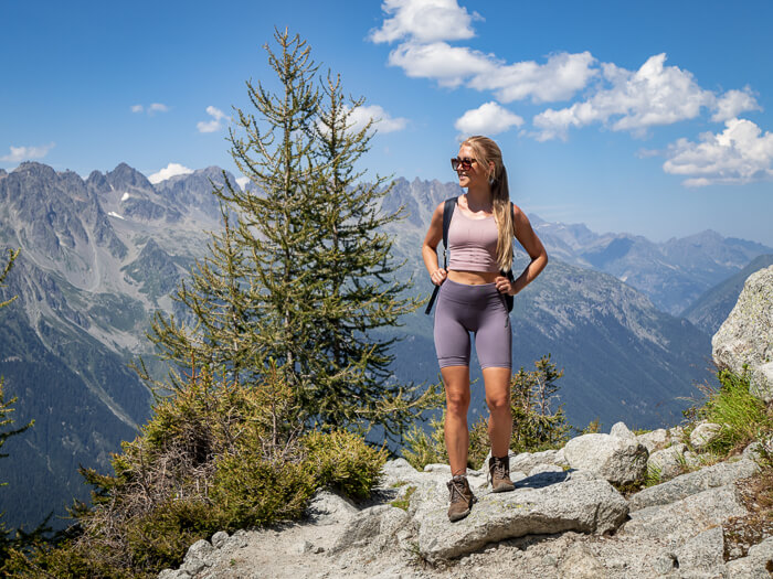
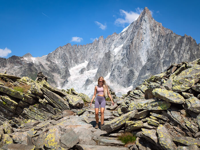
As you approach the final third of the hike, the trail splits into two. Make sure to take the path on the right, the one leading to the Signal Forbes viewpoint (or ‘Le Signal’). It’s a bit of a climb but 100% worth the effort. Believe me, you don’t want to miss this view!
Soon you’ll reach a section where the lush green meadows transform into a bizarre landscape with huge piles of loose flat rocks. It’s like you’re suddenly on a totally different hike!
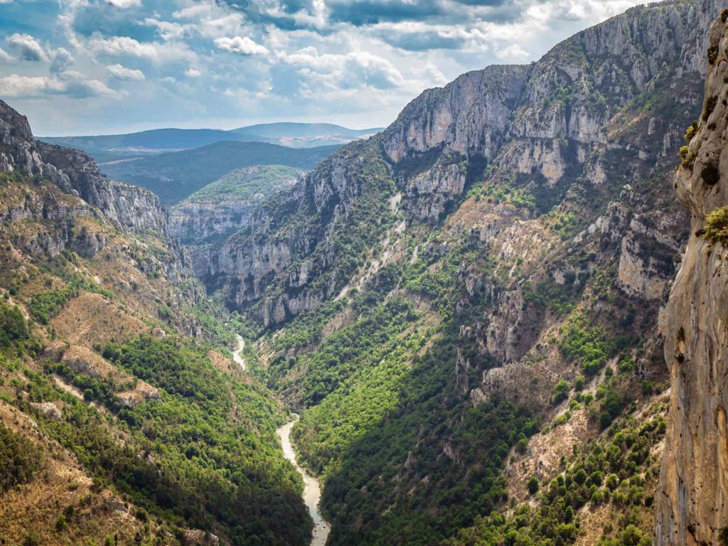
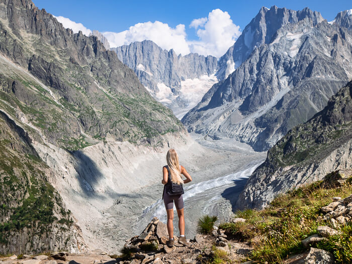
Shortly after, you’ll arrive at Signal Forbes, marked with a sign and numerous cairns. Follow the small path that branches off the main trail to reach a vantage point where you’ll be rewarded with a breathtaking panorama of the Mer de Glace glacier and the awe-inspiring peaks around it. You can even see Italy’s Grandes Jorasses mountains from here. It’s truly a sight to remember and definitely the highlight of the Grand Balcon Nord hike!
Once you’re done soaking up the incredible views and the grandeur of this landscape, continue the hike and you’ll soon arrive at Montenvers. Here you’ll find the charming Refuge du Montenvers hotel, a train station and a restaurant where you can refuel yourself with some lunch or a cold drink.
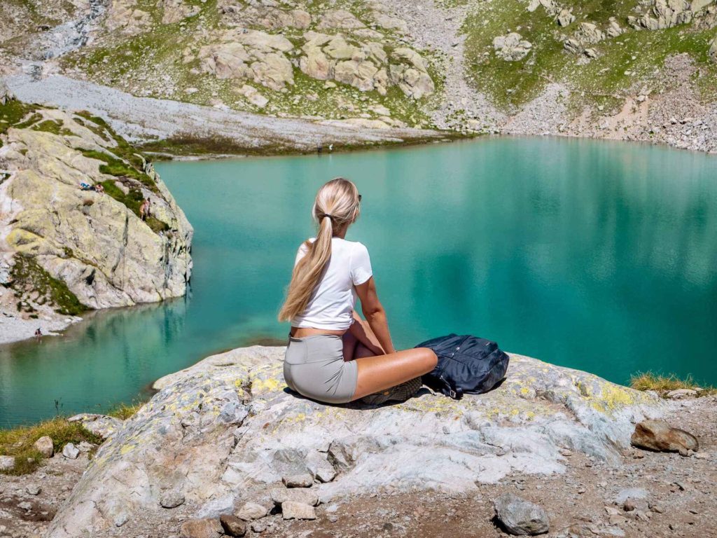
Visiting Mer de Glace and the ice caves
At Montenvers you also have the opportunity to get a closer look at Mer de Glace. Literally translated as Sea of Ice, it’s the largest glacier in France and has a length of 7 km (4.3 mi) and a depth of 200 m (656 ft). It’s a rapidly receding glacier and a place where unfortunately the effects of climate change are glaringly obvious.
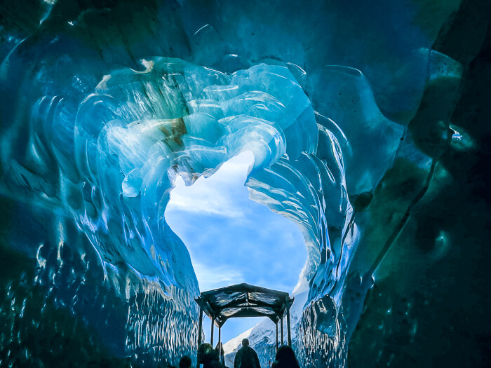
Every year ice caves (Grotte de Glace) are carved into Mer de Glace, which you can access by either taking a small gondola down to the glacier or hiking down a short trail. Here you can take a walk inside the glacier and marvel at the vivid blue ice walls and sculptures made of ice.
There’s also a museum about crystals and the Glaciorium exhibition space, where you can learn about the formation and evolution of Mer de Glace.
Getting back to Chamonix
Once you’re done exploring Mer de Glace and Montenvers, you have two options to get back down to Chamonix – taking the Montenvers train or hiking.
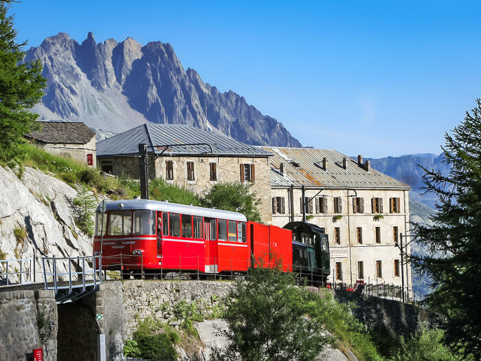
The little red cogwheel train has been operating since 1909 and is a tourist attraction on its own. During the 20-minute journey from Montenvers to the center of Chamonix (or vice versa), the train takes you down the mountainside and offers some wonderful views along the way.
If you plan to use this option, make sure to check in advance when the last train departs so you wouldn’t miss it! It’s usually around 4 or 5pm. See the schedules, ticket prices and latest updates here.
If you choose to hike to Chamonix as we did, be aware that it adds an additional 5 km (3.1 mi) to the total distance. The trail starts right next to Refuge du Montenvers. It descends through a forest, passing the small Chalet Buvette de Caillet café and finishes at Domaine des Planards in Chamonix.
Alternatively, you could also spend the night at Refuge du Montenvers. This 19th-century hotel offers a truly unique stay right on the edge of Mer de Glace and features cozy rustic rooms with mountain views.
The best time to do the Grand Balcon Nord walk
The best time to hike Grand Balcon Nord is from July to October. In spring and early summer, it’s likely that the trail is still covered with snow, though this changes from one year to another. If you want to do the hike in spring, La Chamoniarde or the staff at the cable car station can give you advice and the latest updates on the conditions of the trail.
Grand Balcon Nord map
On the map below, I’ve marked the Grand Balcon Nord walking route and also the optional hiking trail down to Chamonix from Montenvers. Click on the icon in the top left corner of the map for more details.
Final tips for the hike
- Riding the Aiguille du Midi cable car is a highly popular thing to do in Chamonix, so book your tickets in advance. Otherwise, you might have to wait for several hours to go up, or worse, you won’t be able to go up at all on your chosen day.
- Instead of taking the cable car up to Plan de l’Aiguille (the starting point of the hike), it is also possible to hike up there from Chamonix. Be aware though that it’s a very steep 5.8 km-long (3.6 mi) ascent. The trail starts at Grépon car park.
- As the weather up in the mountains can change quickly, take some extra layers with you. It would also be smart to bring sunglasses and sunscreen.
- If you want to spend a night at Refuge du Montenvers at the end of the Grand Balcon Nord hike, be sure to make a reservation well in advance as the rooms sell out quickly.
Take a look at my other France travel guides as well:
- Provence road trip: a 5-day South of France itinerary
- 11 scenic lakes to visit in France
- Route des Cretes Verdon, a panoramic drive in the South of France
Enjoyed reading about Grand Balcon Nord? Pin it!
READ MORE: